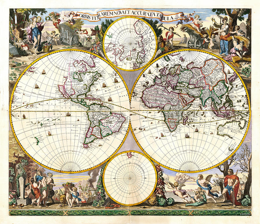
Orbis Terrarum Nova et Accurata Tabula

by Weston Westmoreland
Title
Orbis Terrarum Nova et Accurata Tabula
Artist
Weston Westmoreland
Medium
Photograph - Photograph
Description
Orbis Terrarum Nova et Accurata Tabula, 1690.
An Unrecorded Wall Map of the World from the Golden Age of Dutch Cartography.This is a finely preserved and previously unknown 4-sheet double hemisphere map of the World.
The map consists of a twin hemisphere world map, together with two polar projections. Surrounding the map are personifications of the four seasons (from upper left to lower right): spring, a dancing bear breasted Persephone is garlanded with spring flowers; summer, Ceres brings in the wheat harvest; autumn, Dionysus accompanied by satyrs and cherubs, collects the grape harvest, and adorn a herm with vines; winter, represented by strong man carrying a stick, Boreas the north wind can be seen blowing, whilst cherubs gut fish.
In the 17th Century, at the height of the Golden Age of Dutch Cartography, Dutch published wall maps became an important decorating statement for aristocrats and wealthy traders in Western Europe. Among the most important of the late 17th Century mapmakers was Frederick De Wit of Amsterdam. De Wit continued the tradition of remarkable wall maps, including maps of the world in 4, 8 and 12 sheets.
Because of the size of these maps very few examples have survived until modern times and they are most typically in poor condition or heavily restored.
The present map is an unrecorded variant of one of Frederick De Wit's multi-sheet masterpieces, published by Gerard Valk, one of the leading map publishers and engravers in Amsterdam at the end of the 17th Century. Known primarily for fine engraving and high artistic quality, Valk's work is among the finest from the latter part of the Golden Age of Dutch Cartography.
The present example is a remarkable survival, especially in such magnificent condition. The condition is, without question, the finest we have ever seen for a multi-sheet wall map of the 17th Century.
More amazing ancient maps and city plans one copy-paste away at https://weston-westmoreland.pixels.com/collections/ancient+cartography
Weston Westmoreland
Uploaded
May 2nd, 2021
Statistics
Viewed 101 Times - Last Visitor from New York, NY on 04/19/2024 at 7:47 PM
Embed
Share
Sales Sheet


