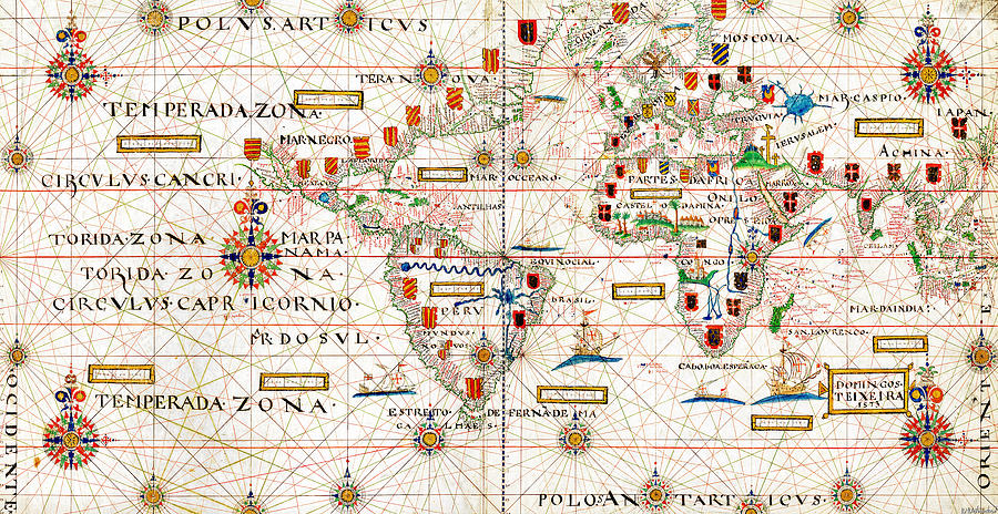
Teixeira Map 1573

by Weston Westmoreland
Title
Teixeira Map 1573
Artist
Weston Westmoreland
Medium
Photograph - Photograph
Description
Teixeira planisphere1573.
This world map was hand painted on a piece of parchment by Portuguese cartographer Domingos Teixeira in 1573, during the reign of Sebastian of Portugal.
This is one of the first full world maps showing the spice routes, both the Portuguese route of Vasco da Gama, following the east route and the Spanish route towards the west, discovered by Ferdinand Magellan. The map is divided by the Tordesillas Meridian.
It also happens it is an exquisite work of art, a delicate polychromy full of color and detail.
Weston Westmoreland.
Uploaded
April 24th, 2021
Statistics
Viewed 108 Times - Last Visitor from New York, NY on 04/15/2024 at 5:08 AM
Embed
Share
Sales Sheet


